

NASA imagery of rare pileus clouds provides new data on atmospheric turbulence and moisture dynamics critical for commercial aerospace launches and satellite operations.
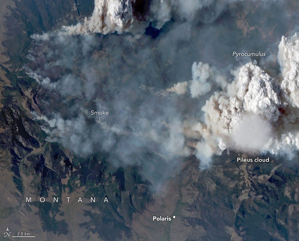
WASHINGTON, DC – NASA Earth Observatory released high-resolution imagery of a pileus cloud this week, signaling intense atmospheric turbulence that impacts aerospace operations. The rare formation occurs when moist air is forced upward over cumulonimbus clouds, condensing at high altitudes. These formations provide data on wind shear and moisture density gradients affecting rocket trajectories and satellite deployment.

A pileus cloud forms above rapidly rising air masses like developing thunderstorms. As the cloud core ascends, it forces overlying air to rise. If that upper layer contains sufficient moisture, it reaches the dew point and condenses into a cap. This process is transient, often lasting only minutes before vertical motion ceases or moisture dissipates.
According to NASA Earth Observatory, a pileus indicates high environmental instability. These clouds help track energy exchange within the troposphere. They mark the boundary where rapid vertical movement interacts with larger scale weather systems.
The conditions represented by pileus clouds have direct implications for the commercial aerospace sector. Rocket launches by entities like SpaceX must navigate atmospheric layers where pressure changes and wind shear induce hardware stress. Understanding these frequencies helps engineers refine launch windows and structural tolerances for spacecraft components.
Satellite operators rely on precise atmospheric modeling to predict orbital drag and reentry conditions. Moisture dynamics captured in pileus clouds contribute to weather patterns influencing long term climate models. Monitoring these rare events allows scientists to calibrate algorithms used in global weather prediction forecasting.
Watch: Strange Cloud Formations

Written by
Tumisang Bogwasi, Founder & CEO of Brimco. 2X Award-Winning Entrepreneur. It all started with a popsicle stand.